CHICAGO (WLS) — ABC7 Chicago AccuWeather meteorologists have issued an AccuWeather Alert for Monday night and Tuesday.
ABC7 Chicago is now streaming 24/7. Click here to watch
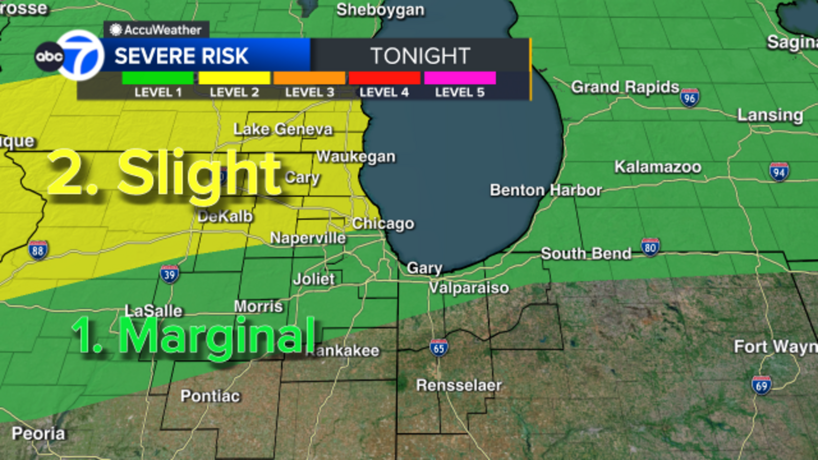
ABC7 Chicago AccuWeather meteorologists have issued an AccuWeather Alert for Monday night and Tuesday.
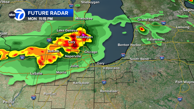
A Severe Thunderstorm Warning is in effect for DeKalb, Boone, Kane and McHenry counties until 11:45 p.m. Monday.
A Severe Thunderstorm Warning is in effect for Cook, DuPage and Will counties until 11:15 p.m. Monday.
A Severe Thunderstorm Watch is in effect Boone, Cook, DeKalb, Grundy, Kane, Kendall, LaSalle, Lake (Ill.), McHenry, Will, Racine, Walworth and Kenosha counties until 3 a.m. Tuesday.
Meteorologists Phil Schwarz and Cheryl Scott said strong storms could produce large hail and damaging winds. There is a low tornado threat, and flooding is possible.

Several rounds of scattered, strong storms began hitting the Chicago area after 10 p.m. Monday.
Areas north of the city are at highest risk for severe storms.
More storms are possible overnight and into early Tuesday before the area gets a break in activity.
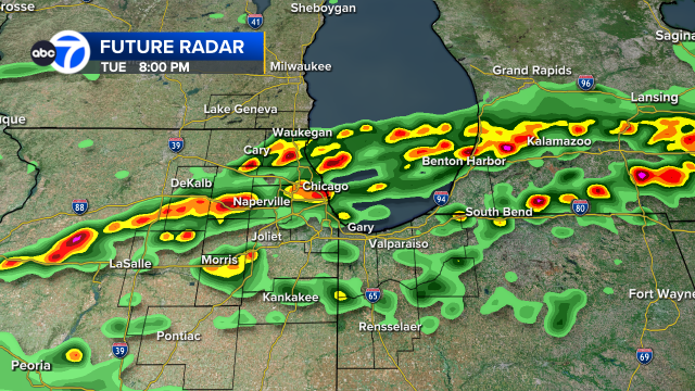
Dry and warm conditions are expected for most of Tuesday before the second round of strong storms arrives after 4 p.m.
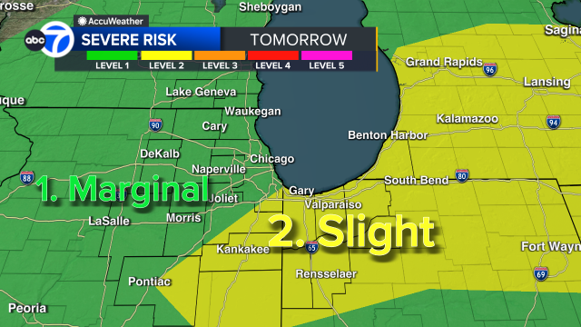
The main threat will shift south of the city on Tuesday night, with storms continuing through midnight.
This comes as temperatures reached 80 degrees on Monday afternoon, breaking the daily record of 79 degrees set back in 1998. It will also be the warmest day of the year so far.
But temperatures will fall sharply late Tuesday as the front moves in.
Looking ahead, temperatures Wednesday will be about 30 degrees colder than Tuesday. More rain and storms are expected on Thursday and again on Saturday.
Cook County Radar DuPage County Radar Will County Radar Lake County Radar (IL) Kane County Radar Northwest Indiana Radar
Copyright © 2026 WLS-TV. All Rights Reserved.