Earlier this month, scientists at NOAA, the National Oceanic and Atmospheric Administration, issued an “El Niño Watch” for this summer. They said there is a 62% chance that El Niño conditions will appear from June through August, growing to 83% by October.
That triggered a lot of hype about “Super El Niños,” “Godzilla El Niños” and other scary-sounding weather events.
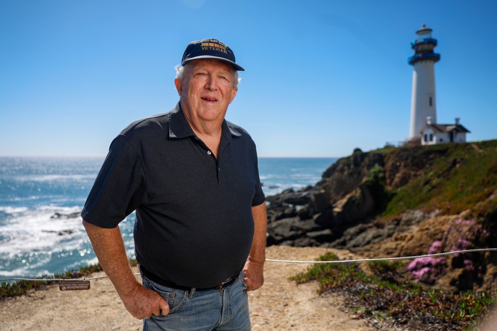
What’s actually going on? Jan Null is a veteran meteorologist who worked as a lead forecaster with the National Weather Service and now runs Golden Gate Weather Services, a company in Half Moon Bay.
This conversation has been condensed and edited for clarity and length.
Q: People sometimes get confused when they hear about El Niño and La Niña. In basic terms, what are they?
A: El Niño is a warming of the ocean waters in the tropical Pacific from just off the Mexico coast to the middle of the Pacific along the equator. It happens every 3 to 7 years or so. But if the ocean waters are cooler than normal in that same area, that’s La Niña. Those changes in water temperature patterns affect circulation in the atmosphere. That has a trickle-down effect on weather across the world.
Q: So how do El Niños affect weather?
A: In broad terms, in North America, you are more likely to have warmer- and drier-than-normal conditions in the Pacific Northwest and Canada and wetter-than-normal conditions across the southern tier of the United States, including Southern California. In South America, it’s drier-than-normal in the Amazon Basin. It’s also drier-than-normal in Indonesia and Australia.
With El Niño, you also have a decrease in hurricane activity in the Atlantic. It doesn’t mean we don’t get hurricanes during El Niño years but often there are fewer of them. The opposite is true in the eastern Pacific Ocean off Mexico and Central America. Hurricane numbers tend to go up there in El Niño years.
Remember, all of these trends are based on averages over a wide range of years. They aren’t absolute. That is probably one of the biggest misconceptions that people have.
Q: There’s a common belief that El Niño means California is guaranteed to have wet winter conditions and La Niña means we are heading for certain drought. What’s the reality?
A: The reality is that on average, we tend to be wetter across much of California during El Niños. But that’s an average of many years and there are some wide swings.
There have been 27 El Niños since 1950. In the Bay Area, rainfall has been below normal in 12 of them and the other 15 have been above normal. In Los Angeles, 10 of those years have had below-normal rainfall and 17 years have had above-normal rainfall.
The takeaway message? El Niño does not guarantee above-normal rainfall in any part of the state. But the frequency of above-normal rainfall during El Niño is greater in Southern California than it is in the Bay Area and even less as you go farther north than that.
Q: In other words, El Niño increases the odds of a wet winter in California, but it’s not as certain as people think?
A: Yes. It is not a guarantee.
Q: There have been headlines lately about a “Super El Niño” with very warm waters developing later this summer. What does that mean? And why do you think there’s so much hype?
A: The idea of a super wet El Niño kind of got reinforced in the winter of 1997-98. There was a lot of hype about it back then. We ended up with double the normal rainfall. Lots of rainy days.
We’ve had three very strong El Niños in recent history — 1982-83, 1997-98 and 2015-16. In those years, we were looking at Pacific Ocean water temperatures at the top end of the scale, in the very strong El Niño category. In 1982-83 we had 195% of normal rainfall in the Bay Area and flooding, and then 180% of normal in 1997-98. But in 2015-16, it was 99% of normal. That’s two out of three that were wet. But it’s not 3 out of 3. That’s the biggest takeaway.
Q: How has climate change affected the El Niño?
A: We’re just getting a handle on that. The oceans are warmer. When we do get storms, they tend to be wetter. And when we get droughts and heat waves, they tend to be drier and hotter. Every weather event has some climate change DNA in it. How much of that is a natural occurrence versus what we have supercharged with a hotter climate is hard to separate out. We need to be looking at decadal numbers. How many more of these wet events do we have in the 1980s, 1990s, 2000s, 2010s, and 2020s?
Q: Over the years, how has the accuracy of weather forecasting improved?
A: When I started in the 1970s, a good forecast went out about 3 days. Now it is about 7 days where have a pretty good handle on what’s going on. We’ve improved about 1 day per decade. That’s primarily due to increasing computing power, satellites, and more buoys in areas where we didn’t have a lot of data. Today we have more data points to go into the computer models. And we are starting to be able to use AI to look at more data, especially historical data, to see weather patterns.
Q: If we can only accurately forecast out for about a week, how is it that NOAA and other agencies can issue El Niño forecasts now for July, August and September, and even farther out?
A: We aren’t that good at predicting very far out, even though we are getting better. They are looking at water temperatures now and changes in the atmosphere now to create seasonal forecasts. They are looking at variations on climate models. It’s not apples and oranges with daily weather forecasts. These are more general probabilities.
Q: If somebody figured out how precisely to predict the correct temperatures and rainfall totals many months ahead, that would be quite valuable, I expect.
A: One-third of the U.S. economy is weather sensitive. If somebody really had the answer, it would affect energy prices, agriculture, commerce in general — how many puffy ski jackets to sell next winter, that kind of thing — and they would buy and sell Bill Gates and Elon Musk both.
Q: What do you think some of the major misconceptions are about weather and weather forecasting among the public?
A: The one that bugs me most is weather apps. People seem to think if it’s on your phone, then that’s what’s going to happen. I tell people to go to the National Weather Service website and get their local forecast. There’s also an app called “Everything Weather” that is based on National Weather Service forecast data. It’s a wonderful app.
Q: Any final thoughts about El Niño?
A: El Niño is complicated. There’s not a nice one-to-one connection where El Niño equals wet winters in California and La Niña equals dry. It shifts the over-under on rainfall. But it’s not a sure bet.
__________________________________________________________________________
Jan Null
Age: 76
Position: National Weather Service forecaster 1974-1997; lead forecaster 1983-1997; founder of Golden Gate Weather Services consulting firm 1997-present; adjunct professor and lecturer in meteorology at San Francisco State University 1987-2012; adjunct professor and lecturer at San Jose State University in meteorology 2013-16.
Hometown: Oakland, Calif.
Residence: Half Moon Bay, Calif.
Education: B.S., Atmospheric Science, UC Davis (1974); M.A., geography/climate, San Jose State University (1992)
Five facts about Jan Null
– Is a Vietnam veteran who served from 1968 to 1970 in the U.S. Army. Worked on helicopter radio systems and flew in more than 50 combat missions.
– Is a serious amateur photographer whose work has appeared in various magazines, including Sports Illustrated.
– Is a leading advocate of warning parents about the danger of leaving children in hot cars. Started noheatstroke.org
– He and his wife have two Vizslas (Hungarian pointers) that his wife takes to dog shows.
– He ran the 100-yard and 220-yard dash and did the long jump at Canyon High School in Castro Valley and then ran track at Chabot College and enlisted in the Army. “I was in really good shape for basic training,” he jokes.