CHICAGO (WLS) — The Chicago area forecast includes potential for severe weather Thursday afternoon, including a chance for tornadoes.
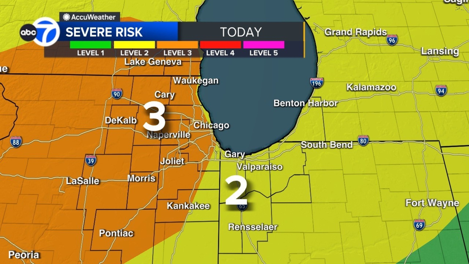
Most of the Chicago area is at a Level 3 risk, with a Level 2 risk for Northwest Indiana and parts of Illinois near the Indiana border.
A Tornado Watch was issued for Boone, DeKalb, Grundy, Kane, Kendall, LaSalle, Lee, McHenry, Ogle and Winnebago counties until 8 p.m.
ABC7 Chicago is now streaming 24/7. Click here to watch
ABC7 AccuWeather meteorologists said parts of the area of a tornado risk of 10%. The main tornado threat is along and west of Interstate 39. The main chance for severe weather is from 3 to 9 p.m.
Wind Advisories are also scheduled to go into effect in the afternoon, with wind gusts up to 45 miles-per-hour.
The Chicago weather forecast includes the potential for severe weather Thursday afternoon, including a Tornado Watch for parts of the area.
The Metropolitan Water Reclamation District of Greater Chicago has issued Overflow Action Alert due to the storms, asking Chicago-area residents limit water usage to absolute necessities.
Storms Thursday morning led to a Ground Stop at O’Hare Airport, which has since been lifted. The FAA said there was still a Ground Delay Thursday evening, with average delays of 375 minutes.
Chicago airport delays, cancellations as of 3:30 p.m. Thursday
– O’Hare: 535 cancellations, average delays of 113 minutes
– Midway: 1 cancellation, average delays of less than 15 minutes
Cook County Radar DuPage County Radar Will County Radar Lake County Radar (IL) Kane County Radar Northwest Indiana Radar
Copyright © 2026 WLS-TV. All Rights Reserved.