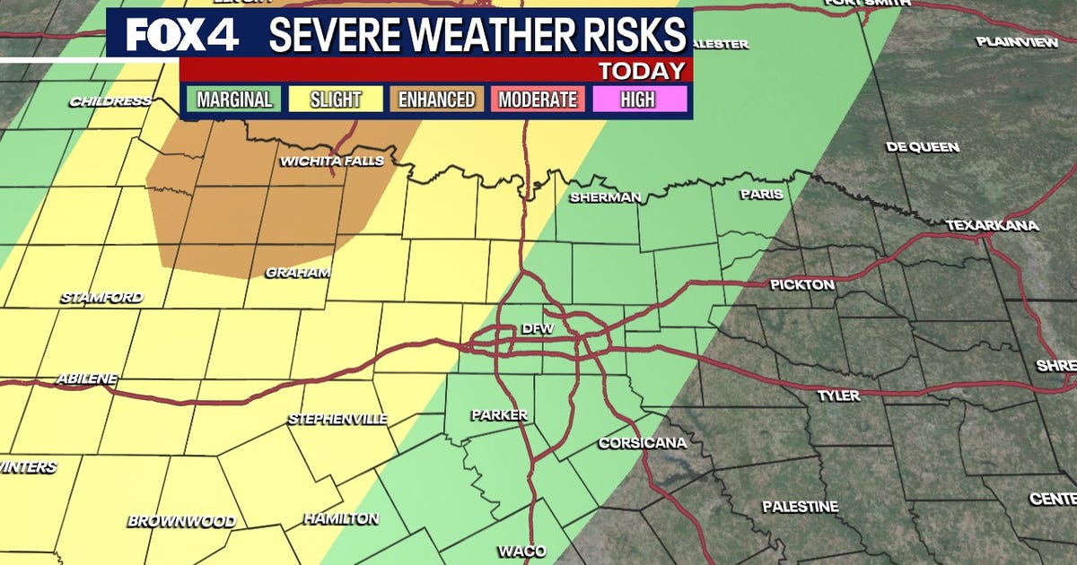
DALLAS – Residents should prepare for a return of severe weather as storms move back into North Texas. The National Weather Service (NWS) warns that high winds, hail, flooding and isolated tornadoes are all possible.
Wednesday Forecast
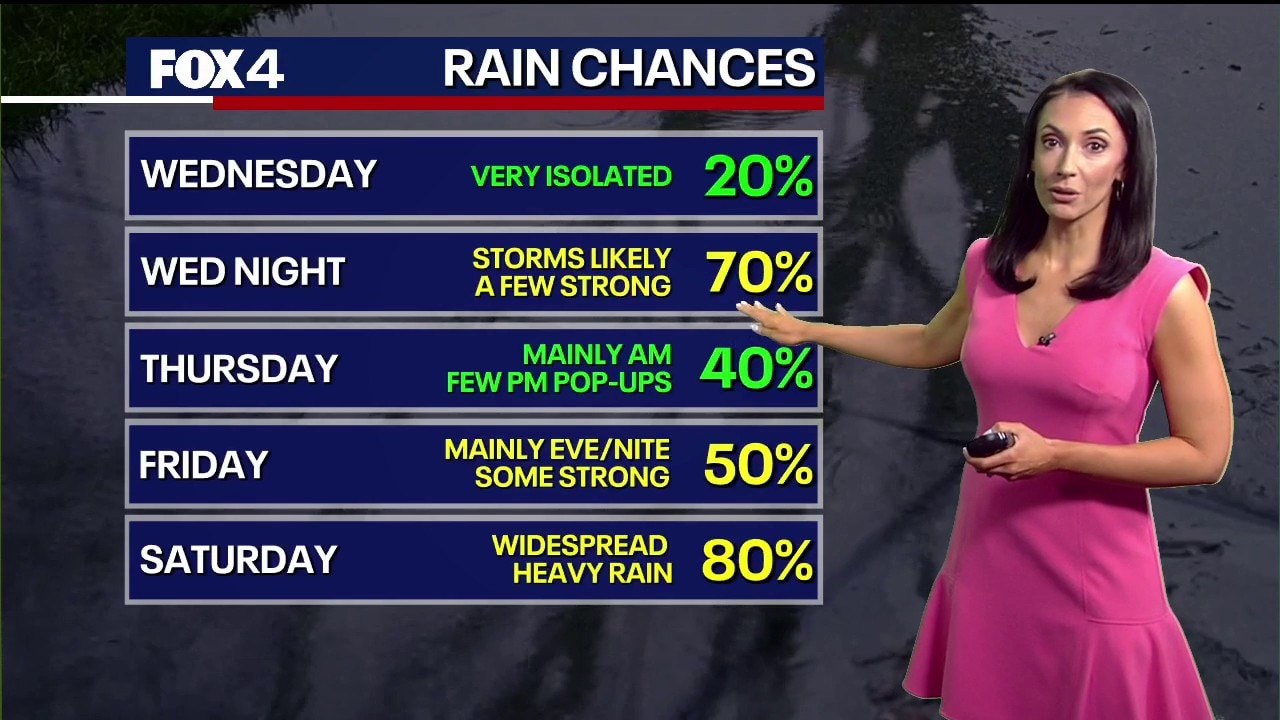
Severe hazards are expected to return Wednesday evening. According to the NWS, the primary threats are large hail and damaging winds.
A dryline to the west will trigger the initial development, with storms pushing east throughout the night. Current models suggest the storms will move through the Metroplex between 1 a.m. and 5 a.m. Thursday. While the tornado threat remains low, it is not zero.
LIVE Radar: Dallas-Fort Worth

Thursday Forecast
The line of storms will continue heading east Thursday morning. Forecasters expect a lull in activity by Thursday afternoon.
Easter Weekend Forecast

The next round of active weather arrives Friday evening, becoming widespread Friday night and lasting into Saturday.
Threats include large hail, damaging winds and localized flooding. While timing remains uncertain this far out, heavy rain is expected to linger through much of Saturday.
A cold front will clear the area from northwest to southeast Saturday afternoon, ushering in noticeably cooler and drier air. Low temperatures late Saturday will drop into the 40s and 50s.
The rain is expected to taper off by Saturday night, leaving Easter Sunday mostly dry and pleasant with highs in the mid- to upper 60s. A slight chance of rain persists for areas south of the Metroplex.
The Source: Information in this article comes from the National Weather Service and FOX 4 Forecasters.