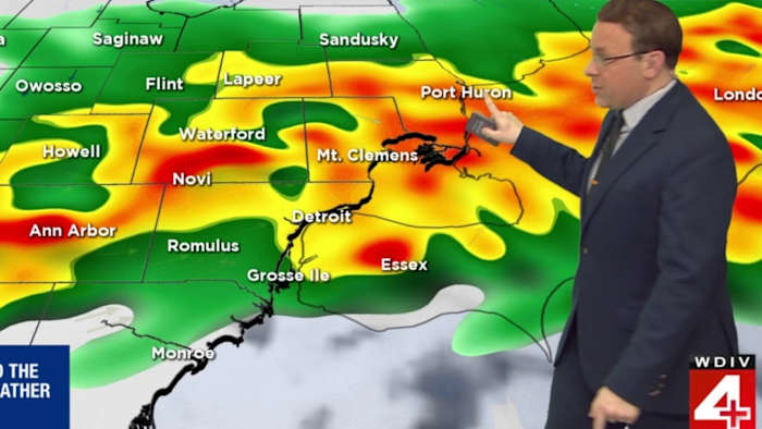
DETROIT – A line of potentially severe storms is expected to move through Metro Detroit on Tuesday night, and the timing is becoming more clear.
The severe weather we’ve been following the past few days is still on track for Tuesday night, and we’ll be watching for severe storm development anytime after 3 p.m.
Strong winds, hail, and even a tornado are all among the risks. Southeast Michigan is under a Level 2 out of 5 risk for severe weather.
As of Tuesday morning, it appears the line of storms that are strong to severe will move through between 8-10 p.m. Tuesday.
There could also be a flash flooding problem due to rounds of heavy rain that last into Wednesday morning.
We’ve got another chance for a Level 2 risk for severe storms on Thursday, with wind and hail as the primary risks in the afternoon and into the evening. We’ll continue to update that forecast over the next 48 hours.
Copyright 2026 by WDIV ClickOnDetroit – All rights reserved.