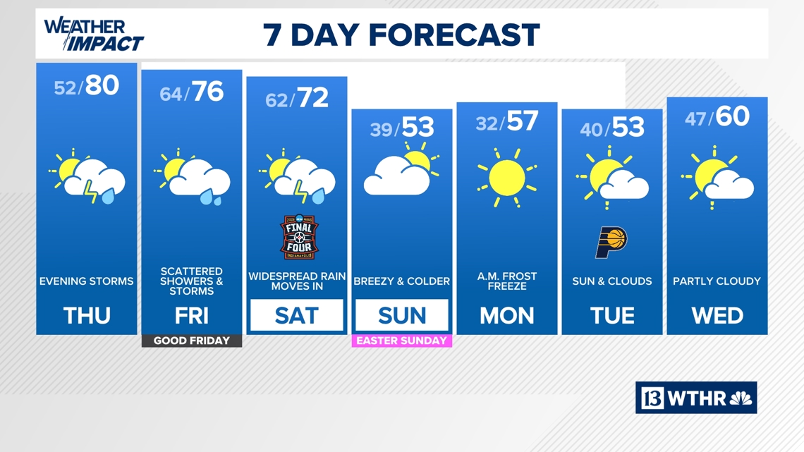
80°+ highs and gusts over 40 mph precede the next batch of potentially severe storms.
The forecast is unfolding just as expected across central Indiana today, with a sharp contrast in temperatures depending on your location.
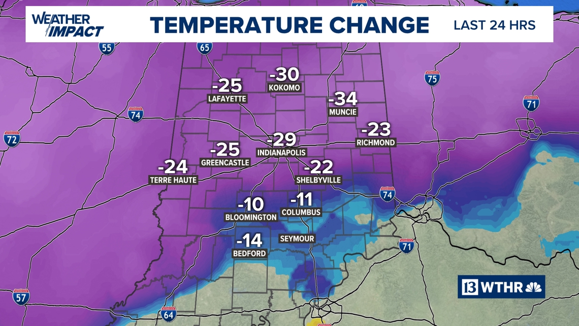
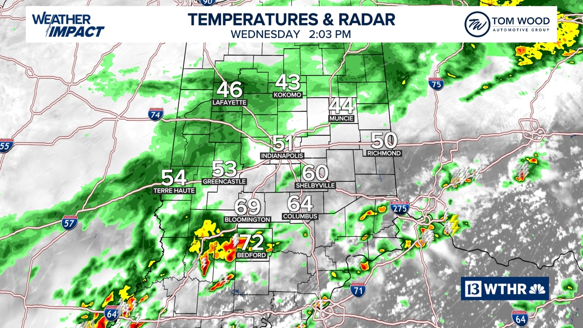
Much colder air has settled in along and north of the I-70 corridor, where afternoon temperatures have dropped into the 40s and 50s — a dramatic change from the near 80° readings we experienced just 24 hours ago. This stark difference is all thanks to a stalled boundary draped across the state.
South of that boundary, it’s a different story.
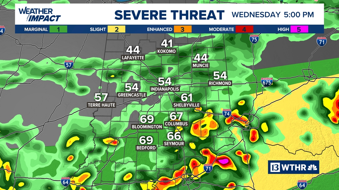
The primary focus for heavier thunderstorms this afternoon will be across south-central Indiana, where warmer and more humid air remains in place. While most storms are expected to stay below severe limits, a few stronger cells could briefly produce wind gusts over 55 mph. In addition, any storm that develops will bring frequent lightning and heavy downpours.
For the Indianapolis metro area, expect a chilly, damp afternoon. Periods of light rain and overcast skies will likely impact after-school practices and outdoor activities, so plan accordingly.
Much warmer For all Thursday
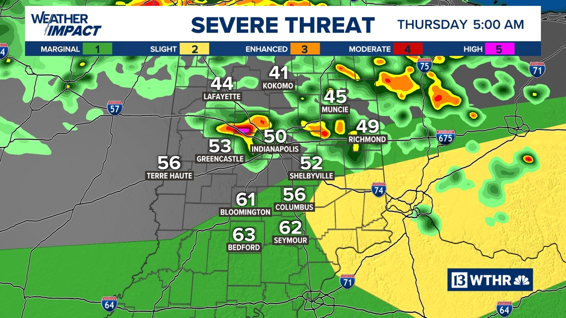
Looking ahead tonight, that stalled boundary will begin lifting northward. By early Thursday morning — before sunrise — we anticipate scattered thunderstorms developing along the returning warm front. Some of these storms could produce small hail as they move through.
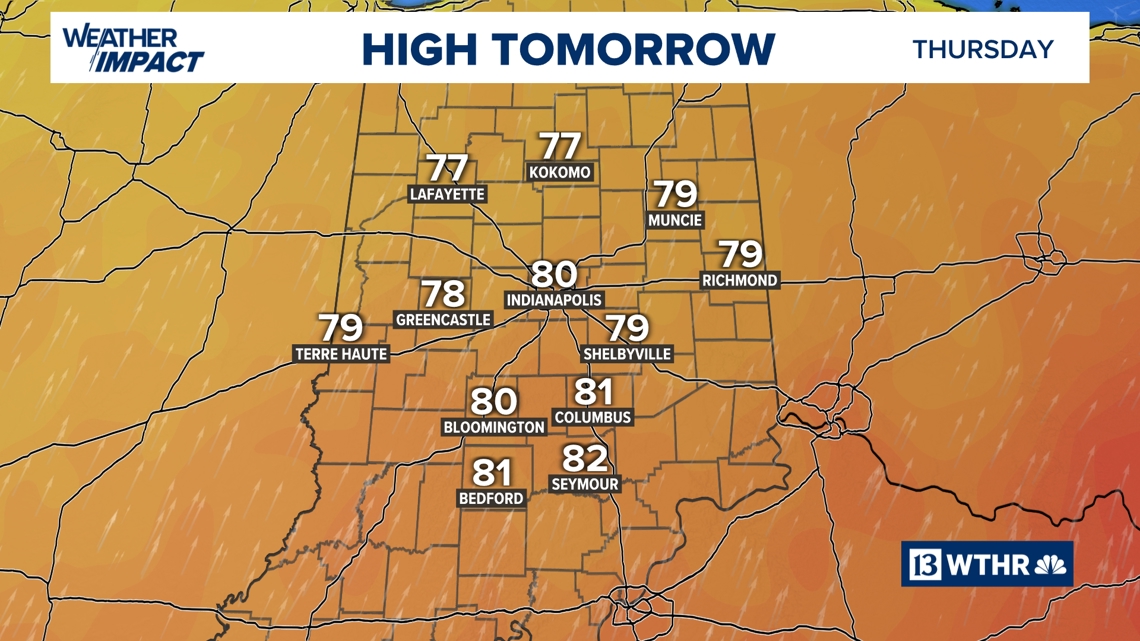
By Thursday afternoon, central Indiana will be firmly back in the warm sector. That means a quick rebound in temperatures, with highs climbing back to 80° or higher.

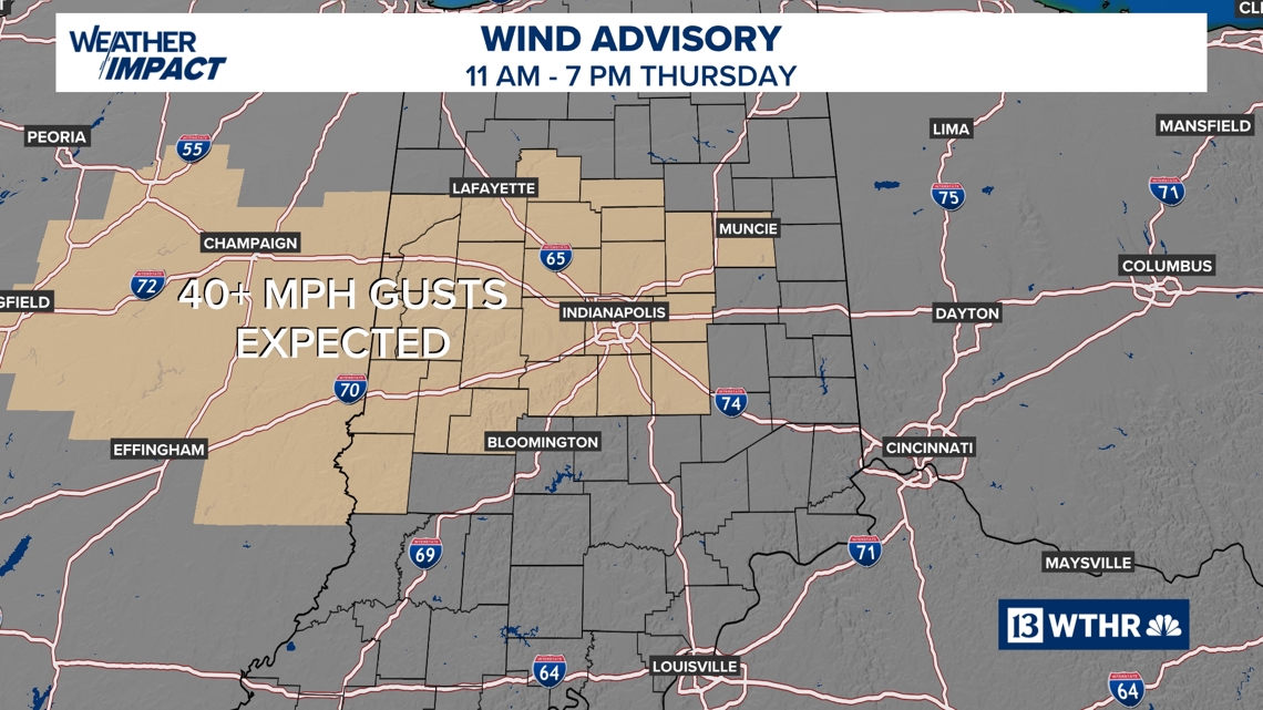
Unfortunately, to get that warm that fast will require a gusty south-southwest wind that may at times exceed 40+ mph. As a result, a Wind Advisory has been issued for 11 a.m. – 7 p.m. Thursday.
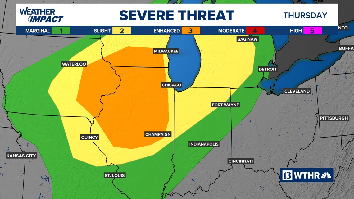
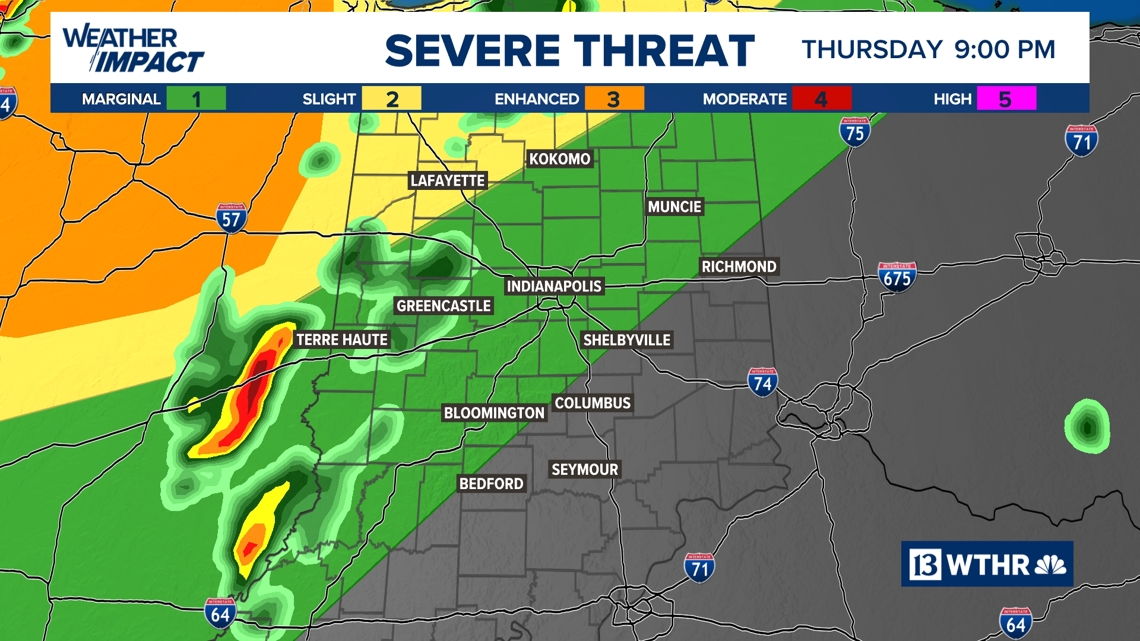
While much of central and northern Indiana is under a Level 2 out of 5 severe weather risk, it’s important to note that Thursday will not be a washout. There will be plenty of dry hours during the day, with the greatest risk for severe storms arriving later in the evening and into the overnight hours.
Final Four weekend
The unsettled pattern doesn’t stop there.
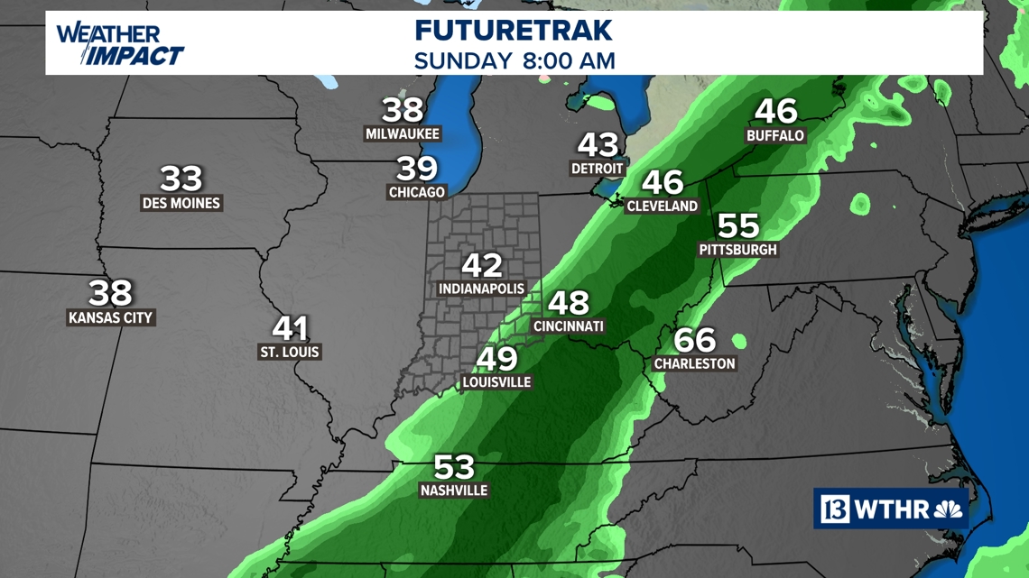
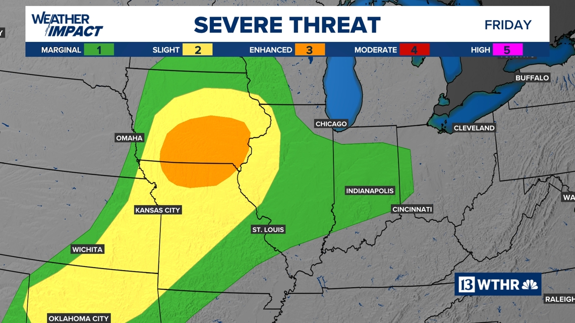
Friday will feature more scattered showers and thunderstorms before a more widespread rain event arrives just in time for Final Four weekend. Expect steady rain on Saturday, along with a few rumbles of thunder at times.
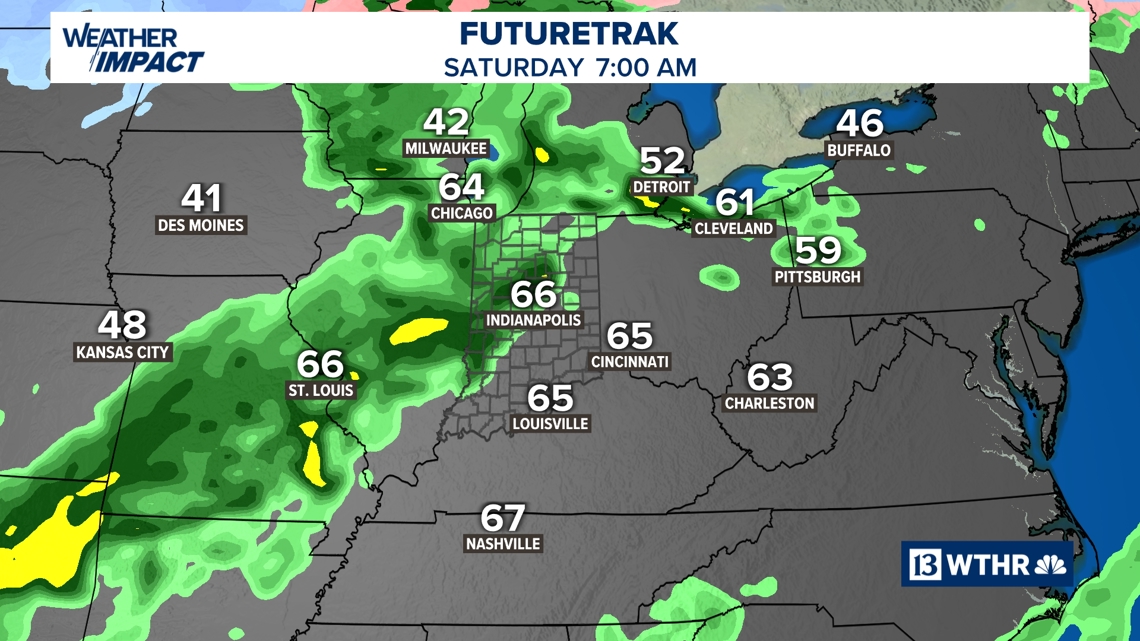
A cold front will finally sweep the rain out of the area late Saturday, setting the stage for a cooler finish to the weekend. Easter Sunday will bring breezy conditions and noticeably chillier air, providing a crisp end to an active stretch of weather.
Stay tuned to WTHR-TV for the latest updates as we continue to track these changes.