We’re tracking the possibility of strong storms Saturday as a cold front ushers in a second round of storms.
KC Sherman, Jordan Darensbourg, Hunter Williams (KVUE)
11:47 AM CDT April 3, 2026
11:07 PM CDT April 3, 2026
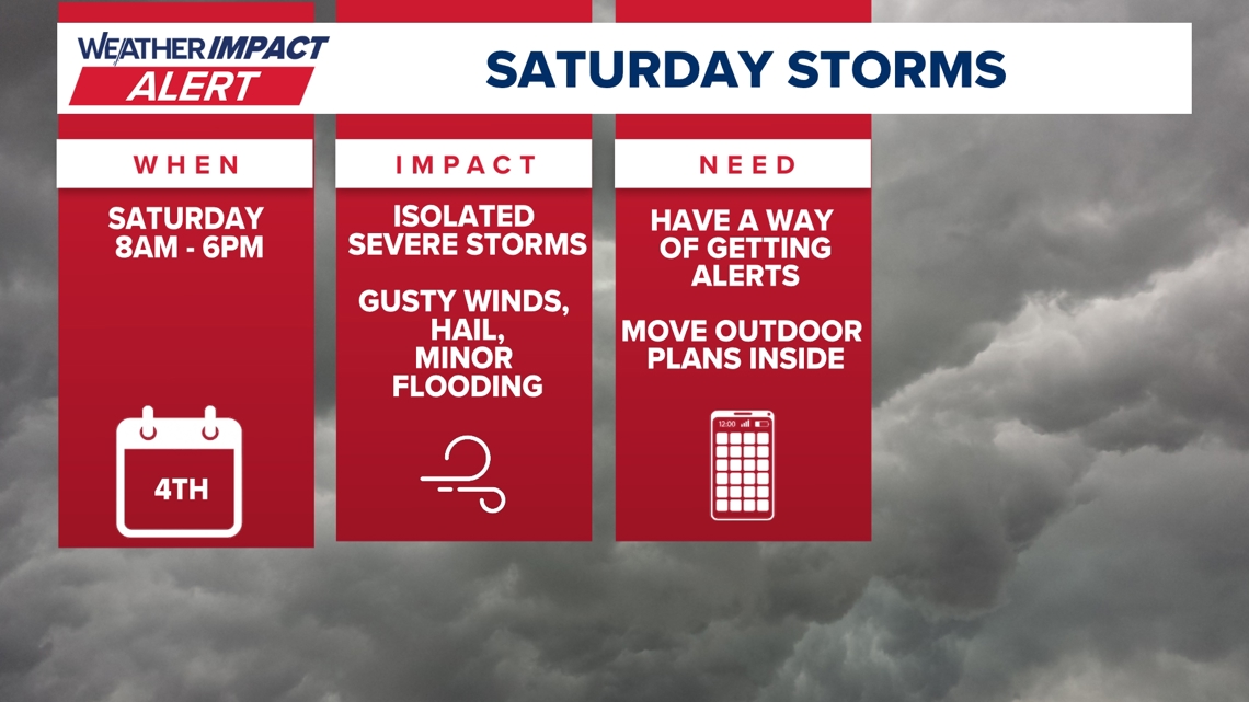
AUSTIN, Texas — Austin residents should prepare for a soggy and potentially rowdy start to the weekend as a cold front sweeps through Central Texas on Saturday. A Weather Impact Alert is in effect from 8 a.m. to 6 p.m. tomorrow, with the primary window for the most intense activity expected around midday.
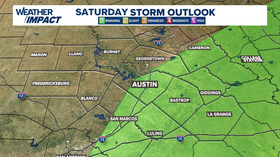
While most of the region is under a marginal risk for severe weather, the greatest threat for organized storms remains focused along and east of the Interstate 35 corridor. By noon, the Future Tracker shows a line of storms cutting directly through Austin and Georgetown, bringing a sharp temperature drop from the upper 70s down into the low 60s behind the front.
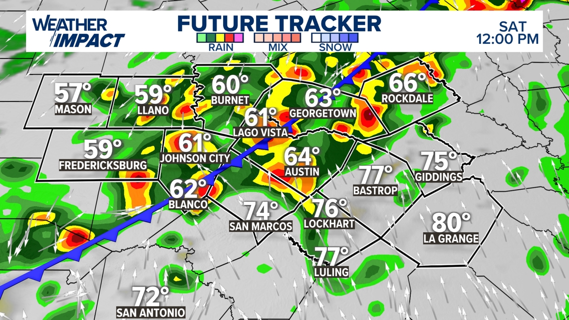
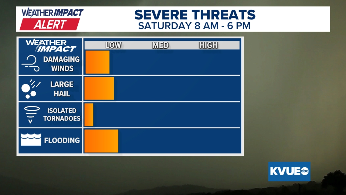
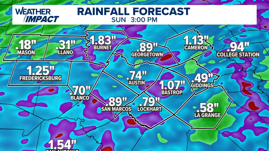
The primary concerns with this system are gusty winds and large hail, though the overall threat level remains on the lower end of the scale. Forecasters are also keeping a close eye on an isolated tornado threat, which, while low, cannot be entirely ruled out as the line of storms gains strength. Minor flooding is another factor to watch, particularly in areas like Burnet where rainfall totals could approach two inches. Most of the Austin metro area can expect between a half-inch to nearly an inch of rain by Sunday afternoon.
It’s a good idea for anyone with outdoor plans on Saturday morning move those activities indoors or reschedule them for Sunday, which looks much quieter. It is also a good idea to have a reliable way to receive weather alerts on your phone, as these storms can intensify quickly as they move toward the Bastrop and Giddings areas.